_out.png)
Blood Rock - Oak Mountain State Park
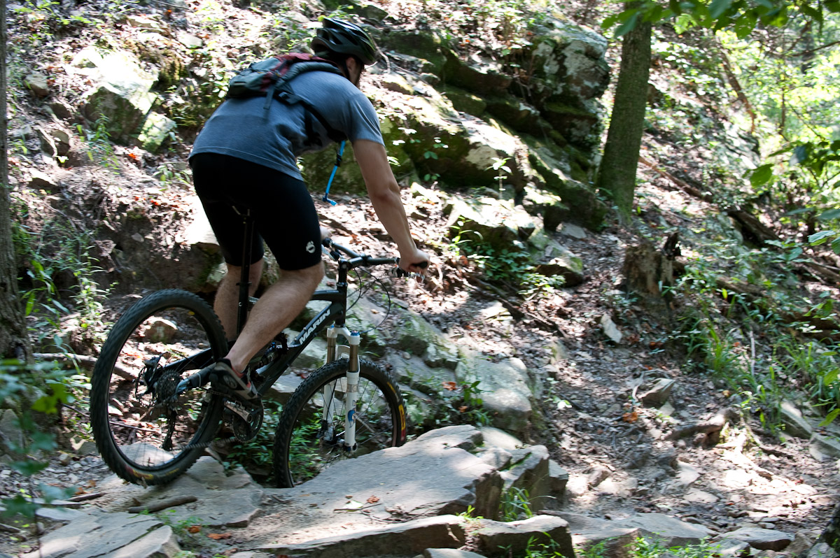
Blood Rock is named after a red trail blaze painted onto a sharp rock next to the trail. Riding down is challenging but easy to master. Riding up is virtually impossible - beware of the wet slippery rocks. Turn left onto the Red Road at the top of the BUMP trail.
The Ride
About 17 miles, the trail (red blazes) is one loop made up of mostly singletrack but some fire/forest/paved roads. Ride either direction. The trails are varied and heavily ridden, and expect to see riders of all ages and abilities, as well as hikers, back-packers, kids, dogs, anywhere on the trail. Please note that bikes are only permitted off road on the red trail. Fines are available from any park ranger for being caught on any other trail with a bike (whether you are riding or not!).
The trail is loosely made up of the following continuously connected sections (traveling counter-clockwise from the South Trailhead):
Mr. Toad's Wild Ride: All singletrack running counterclockwise along the loop from the South Trailhead approximately.85 miles. Ends at the junction of the bike trail and the horse trail next to Peavine Road. No hills but some tight turns and a few narrow spots between trees. Very smooth and flowing.
Foreplay: Continuing counterclockwise along the loop from the horse trail to the bottom of Johnson's Mountain, Foreplay is also all singletrack. Only 1/2 mile long, very smooth and flowing, and contains one sharp S-turn followed by a short bumpy downhill to the bottom of Johnson's Mountain. Go straight across the gravel lot at the bottom to get to Johnson's Mountain.
Johnson's Mountain: ~1.9 miles of hilly woody singletrack. The first section crosses a creek on a bridge then follows the creek, then climbs to the spine of Johnson's first ridge. Hundreds of manhours of trail work in 1997 by B.U.M.P. created a steady climb and quick descent along Johnson's other two ridges. Trail continues downhill through a banked turn and crosses a bridge before crossing Peavine Road.
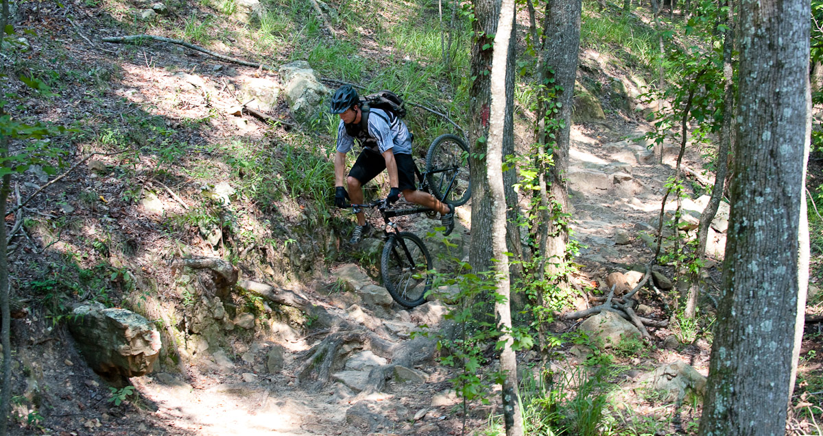
BUMP Trail: This is singletrack that climbs about 1.25 miles to the Red Road at the top of the ridge. Hilly but smooth at the bottom, and rocky, technical and steep at the top. A purpose-built log crossing, Blood Rock, and a set of tight, rocky switchbacks mark the upper part of the trail. Blood Rock is named after a red trail blaze painted onto a sharp rock next to the trail. Riding down is challenging but easy to master. Riding up is virtually impossible - beware of the wet slippery rocks. Turn left onto the Red Road at the top of the BUMP trail.
Red Road:This is a fire road leading ~5 miles counterclockwise from the top of B.U.M.P. to the North Trailhead parking area. The last 2.5 miles are a heart pounding downhill, with 8 creek crossings made smooth by mortared flagstones placed by the Civilian Conservation Corps. Great for catching big-air, but watch out for the rocky landings. Keep control of your bike, as the Red Road is also used by hikers, and bikers riding up-hill. The Red Road ends at the North Trailhead parking lot on the main park road. To continue on the bike trail, turn left ~100 yards before the gate at the end of the Red Road and follow the red trail markers across the bridge. **Do not turn left too early - this will take you down the yellow trail to Maggie's Glen: an area off-limits for bikes.
Red Road to Cabin Road: Woody, smooth singletrack running roughly parallel to the main park road. One moderate climb at the end places you at the park road leading to the cabins. Cross the cabin road (paved) to continue on the bike trail.
The Chimneys: After climbing to the top of the ridge from the cabin road and descending to the foot of the hill, look for the remnants of a cabin (especially the brick chimney) on your right. This singletrack trail takes you through tight turns where roots grab your wheel and trees grab your handlebars. After crossing a wooden bridge, look for the remote control car track on your left. About 100 yards later the trail crosses the Day Use Area park road. Water is available at the Day Use Area from a spigot at the end of the pavement by the big field. Cross the road and continue on the trail.
Rock Garden: Lots of white-tailed deer sightings in this area, especially in the early mornings. The rock garden is quite challenging, and ends with a short climb and then a descent to the Group Primitive Camping Road, with a large fallen tree crossing at the bottom. **If you do not want to ride over the tree - get off and carry your bike over. DO NOT ride around it - the trail in this area has been getting too wide recently, due to numerous short cuts made by lazy riders! Turn right onto the Group Primitive Camping Road to continue on the loop.
Group Primitive Camping Road: ~1.6 miles, a dirt access road suitable for cars. The singletrack picks up again on the left almost at the end of the Camping Road, before the gate. NOTE: The parking area by the gate is an alternative start/finish place for a ride, but please DO NOT BLOCK THE GATE if choosing to park here.
Seven Bridges: The final section of trail, actually contains 8 bridges (we only discivered this a couple of years ago when we numbered them!). ~1.9 miles of moderate uphill woody singletrack, very similar to Mr. Toad's, with
more grade. It ends on Terrace Drive (the paved road on the way to the South Trailhead).Turn left onto Terrace Drive to get to the South Trailhead.
Terrace Drive to South Trailhead: Paved road, which passes the paddle boat house and the BMX track on the way to the South Trailhead parking area. ~ 0.85 miles, watch for crowds (in the summer and weekends especially) and cars with distracted drivers on this road.
The Family / Beginner Trail